Virtual
Tour > Intro > What Causes an EQ > How we locate EQ's > Equipment > Volcanoes > The End!
Mt. Saint Helens
 |
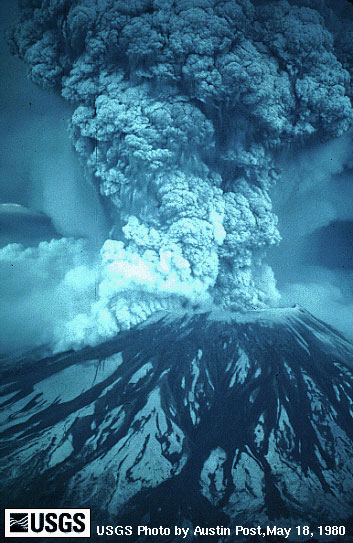
This incredible photograph was taken during
the 1980 eruption of Mt. Saint Helens. Before this great
eruption, Mt. Saint Helens was the 5th highest peak
in Washington at 9,677 feet. After the eruption, Mt.
Saint Helens was 8,363 feet high, a loss of 1,314 feet.
This was the largest eruption in recorded history. This
rather large eruption was triggered by a 5.1 earthquake
1 mile below the volcano. |
Below is a profile view of Mt. Saint Helens
during the eruption. The bottom of these two diagrams show
what the size of the volcano used to be compared to the
size after the eruption.

| To the right is a map of
the ash fallout in the U.S. after the 1980 eruption.
The ash column reached 12 miles into the atmosphere
just 10 minutes after the eruption. The ash eventually
encircled the entire earth in just 15 days. |
|
Mt. Saint Helens is a relatively young volcano
compared to the other volcanoes in the Cascade mountain
range (~40,000-50,000 years old) and is obviously a very
active volcano. Just like Rainier, we are constantly monitering
the volcano for any seismic activity. To see the current
seismicity of Mt. Saint Helens, click here.
To see a general fact sheet and other intriguing
pictures, as well as learn more about Mt. Saint Helens,
click here.
Next>>>
|
|