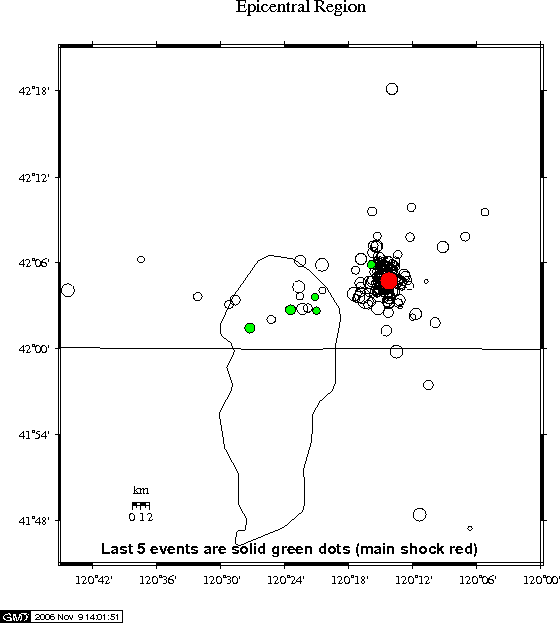
Note that the epicenters shown here are preliminary. This area in southeast Oregon has few seismographs and falls outside of the earthquake region that the PNSN normally covers (this area is normally covered by the NEIC ). However, to make the epicenter map as accurate as possible we have integrated seismic data from the PNSN, the USGS, and the University of California, Berkeley. The map below, showing routinely processed locations, indicates an apparent N-S scatter of epicenters that is misleading. The N-S scatter is caused by the fact that most seismograph stations are located to the west; there are very few seismic stations north and south of the epicenters in this region. A more careful analysis shows that almost all of the epicenters are actually located at one spot.

Did You Feel It? - You can report shaking and damage at your location. You can also view a map displaying a summary of data received from all reports.
View Seismograms - View web-based seismograms by station and date.
Maps and History of Earthquakes in this Region
Focal Mechanism - Information for this earthquake.
Related Information - Most Up-to-Date Local and Global Earthquake Summaries