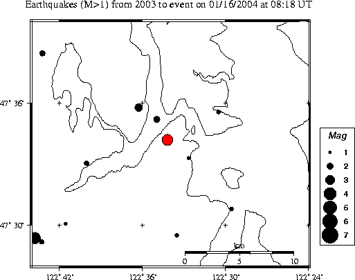
| Magnitude | 3.6 |
|---|---|
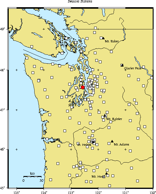
| Time | Friday January 16, 2004 at 08:18:18.51 Z (UTC) Friday January 16, 2004 at 00:18:18.51 AM (PST) | Distance from | 4.5 km E of Bremerton, WA 18.1 km W of Seattle, WA (1st & Yesler) 19.2 km SSE of Poulsbo, WA |
| Coordinates | 47.570 deg N 122.570 deg W |
| Depth | 50 km |
| Quality | good (BA) |
| Note: 1 km = 0.621 mile or 1 mile = 1.61 km | |