PNSN > Catalogs and Data > Historic EQs of the PNW > Recent Notable Earthquakes > Special Event
|
FEBRUARY 28, 2001 NISQUALLY EARTHQUAKE
Basic Information
Time of Occurrence (GMT): Wednesday February 28, 2001 at 18:54:32.78 Z
Time of Occurrence (PST): Wednesday February 28, 2001 at 10:54:32.78 AM
Depth (km) 52.40
Magnitude (Mw) 6.8 - Moment magnitude from the USGS National Earthquake Information Center.
Location 47.1525N 122.7197W
    17.6 km  NE of Olympia, WA
    23.7 km WSW of Tacoma, WA
    57.5 km SSW of Seattle, WA
Name of data file: 01022818543p
SHAKING INTENSITIES
EARTHQUAKE REPORTS
REPORT YOUR EXPERIENCE
MORE INFORMATION ON:
- General
- Cross Section showing Deep and Shallow suites of
quakes, plus focal mechanisms in side view for 1949,1965, and 2001
- Technical
- Special Pages from other organizations
- More Links - Sand Rose, Thunderbird and Whale, Media Links
Detailed Information and Graphics about the Earthquake
Our data base of earthquake hypocenters contains information
from the 19th century to the present.
Included are:
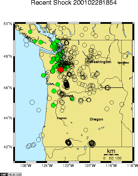
- A map of the Pacific Northwest
showing the location of the earthquake (in red) plus prior earthquakes M > 3.5.
Shallow events are black. Events deeper than 35 km are green.
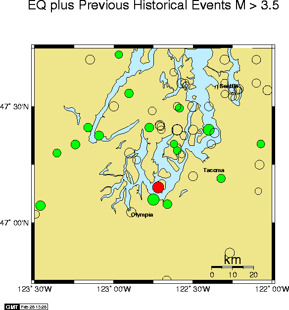
- A map showing a closer view
of the earthquake and prior historical earthquakes
with magnitude 3.5 or greater.
Shallow events are black. Events deeper than 35 km are green.
- A list of 10 big earthquakes
preceding the mainshock that are closest to it and have a
magnitude greater than 3.5. These are the most significant
historical earthquakes in the vicinity of the mainshock
(see the closer view map above).
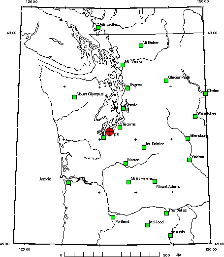
- A map showing
the location of the earthquake relative to cities.
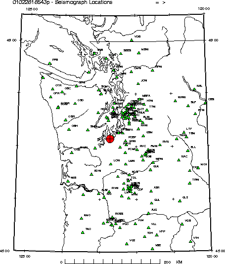
- A map showing
the location of the earthquake relative to the nearest
seismograph stations that recorded it.
- A detailed list of all earthquakes
(M > 1.0) that occurred in the vicinity of the special earthquake
in the previous two years. For the locations of these events see
the next map.
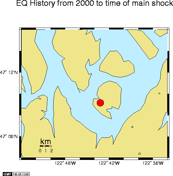
- A map of all earthquakes
(M > 1.0) that occurred in the two years prior to the special earthquake.
Detailed area shown is just few kilometers around the mainshock.
- A List of the nearest 20 strong motion sites
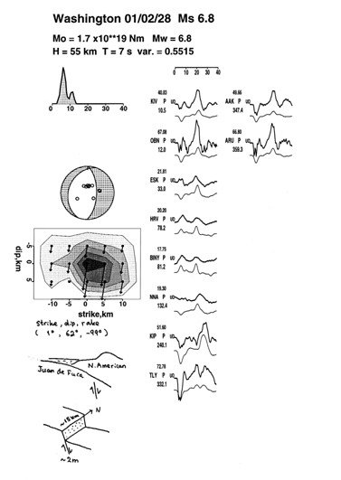
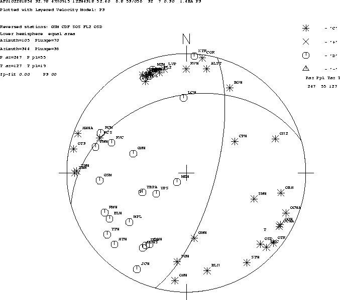
Earthquake Mechanism
If sufficient P-wave first motion data are available,
a fault plane determination for the earthquake
will be available in the form of
Interactive view mechanism and smaller earthquakes with 3-D viewer. Similar to
Figure 1 in SRL article: "Preliminary report on the Mw=6.8 Nisqually,
Washington earthquake of 28 February 2001", SRL, V 72, May/June 2001.
Preliminary Strong Motion Information
|
|
|
| 

