Nisqually Earthquake and Aftershocks
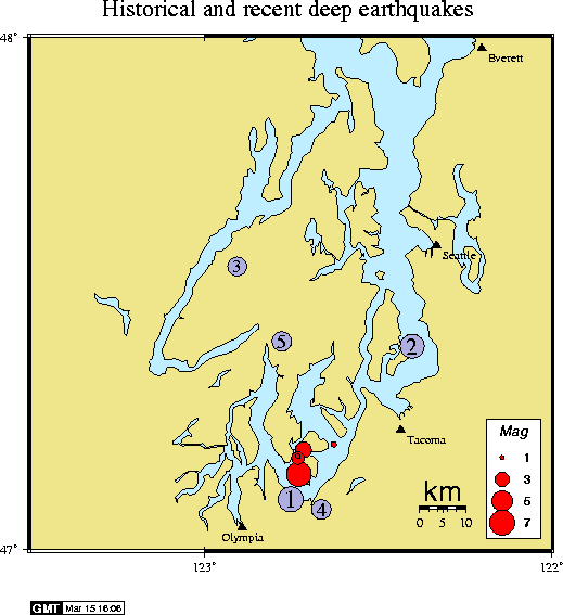
The large red dot shows the February 28, 2001 M6.8 Nisqually earthquake. Aftershocks are also shown in red. Some historical deep earthquakes (M>4) are also shown in purple:
Recent deep earthquakes include the following:
 DATE-(UTC)-TIME   LAT(N) LON(W)   DEP  MAG QUAL COMMENTS
yy/mm/dd hh:mm:ss   deg.   deg.    km   Ml
01/02/28 18:54:32  47.14N 122.72W  51.9 6.8  BA  FELT
01/02/28 19:02:03  47.18N 122.72W  52.3 1.0  BA
01/03/01 09:10:20  47.19N 122.71W  54.3 3.4  BA  FELT
01/03/01 14:23:34  47.18N 122.72W  51.4 2.7  BA  FELT
01/03/11 11:57:36  47.20N 122.62W  47.8 1.2  AB