Information contained in this report is preliminary,
and should not be cited for publication.
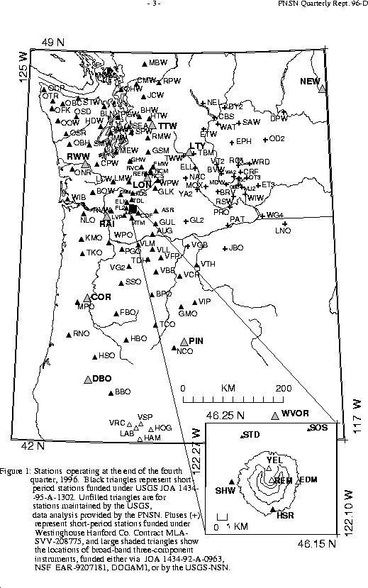
Seismograph network operation in Washington and Oregon is supported by the state of Washington and the following contracts: U.S. Geological Survey Joint Operating Agreement 1434-95-A-1302 and Westinghouse Hanford Company Contract MLA-SVV-208775
The largest earthquake within our network this quarter (on December 15 at 08:34
UTC)
was only magnitude 2.9. However, an earthquake of magnitude 6.2 occurred
on the Nootka fault, off of the west coast of Vancouver Island, British Columbia
.
This earthquake occurred at 20:13 UTC on October 6, and was located (by the NEI
C)
at a shallow depth at 48.8 degrees north latitude and 128.4 degrees west longitu
de.
It was not reported felt.
It is not shown in our figures because it is outside our reporting area.
More information is available:
10/6/96 Earthquake - Offshore Vancouver Island, B.C.
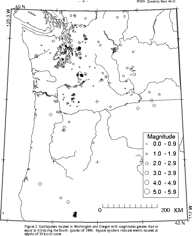
During the fourth quarter of 1996, 312 earthquakes were located between 45.5-49.5 degrees north latitude and between 121-125.3 west longitude. The deepest earthquake this quarter was a magnitude 2.7 event on December 17 at 05:53 UTC at a depth of about 57 km. Its epicenter falls between San Juan and Wa ldron Islands.
Two small earthquakes were reported felt in western Washington this quarter. Both were located at shallow depths (around 5 km) near Duvall, where a magnitude 5.4 earthquake occurred on May 3 at 04:04 UTC. This quarter's larger event, magnitude 2.6, occurred on Oct. 27 at 07:53 UTC and the smaller event was magnitude 2.3 on November 13 at 06:12 UTC.
In the Duvall area, activity this quarter included 25 earthquakes. For comparison, 382 were located in the same area during the second quarter, and 57 earthquakes during the third quarter. The largest earthquake in the Duvall vicinity this quarter was the magnitude 2.6 felt event discussed above.
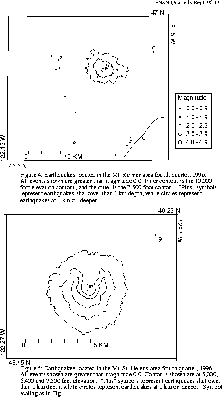
A total of 59 events (21 of them smaller than magnitude 0., and thus not shown in Fig. 4) were located within the region shown in Fig. 4. Of these, 16 were located in the "Western Rainier Seismic Zone" (WRSZ), a north-south trending lineation of seismicity approximately 15 km west of the summit of Mt. Rainier (for counting purposes, the western zone is defined as 46.6-47 degrees N latitude, 121.83-122 degrees W longitude). Closer to the summit (within 5 km), there were 25 tectonic-style earthquakes, and 5 "L" or "S" events were located this quarter (types L and S are not shown in Fig.4). The remaining events were scattered around the cone of Rainier as seen in Fig. 4.
During the fourth quarter of 1996, 45 earthquakes were located in eastern Washington. None were reported felt. The largest quake in the area that we refer to as "eastern Washington" for reporting purposes, actually occurred in Oregon this quarter. It was on December 14 at 21:50 UTC, had magnitude 2.3 and was located at a depth of about 2 km between Pendleton and Uma tilla.