 Seismic
records of the Swift Resevoir Power Canal collaps on April 21, 2002
Seismic
records of the Swift Resevoir Power Canal collaps on April 21, 2002
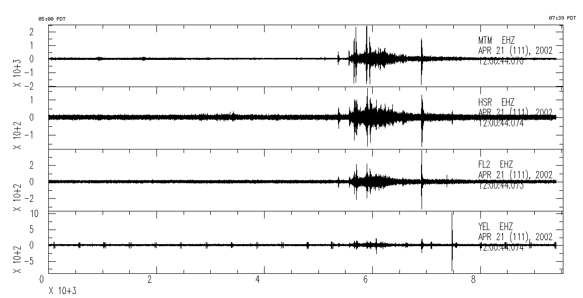
Record starts at 05:00 PDT on Apr 21, 2002 and lasts for 159 miniutes (9530 sec) until 07:39 PDT. Stations and distances are: MTM 6.2km, HSR 13.3km, FL2 15.7km, YEL, 16.7km. Station YEL is located in the crater of Mount St. Helens. The regular spaced 'glitches' on its seismogram are telemetry periodic telemetry noise. The spike event at time 7,450 sec strongest on YEL is a very small earthquake at the Dome in the crater.