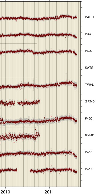
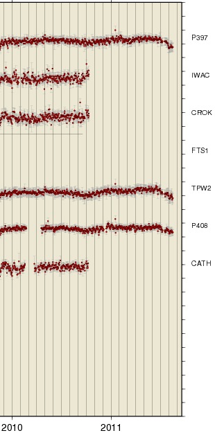
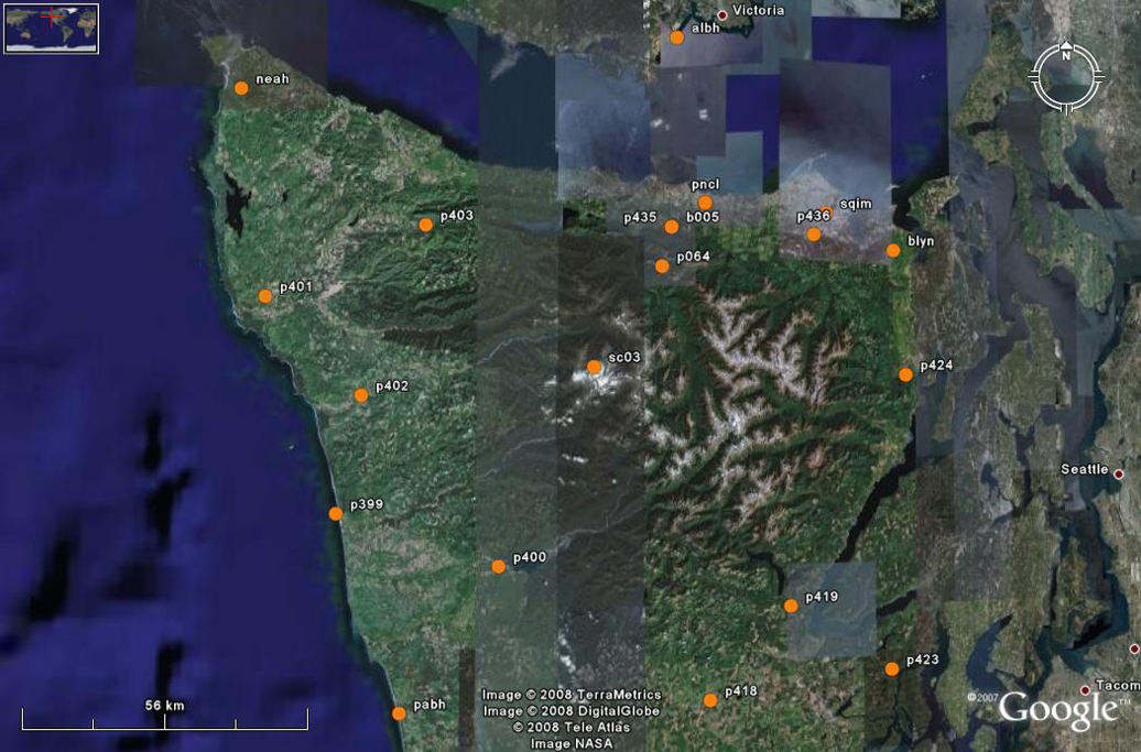
The following ~ one and half year plots are from the
Pacific Northwest Geodetic Array at Central Washington University.
These are static versions appropriate for this ETS of the
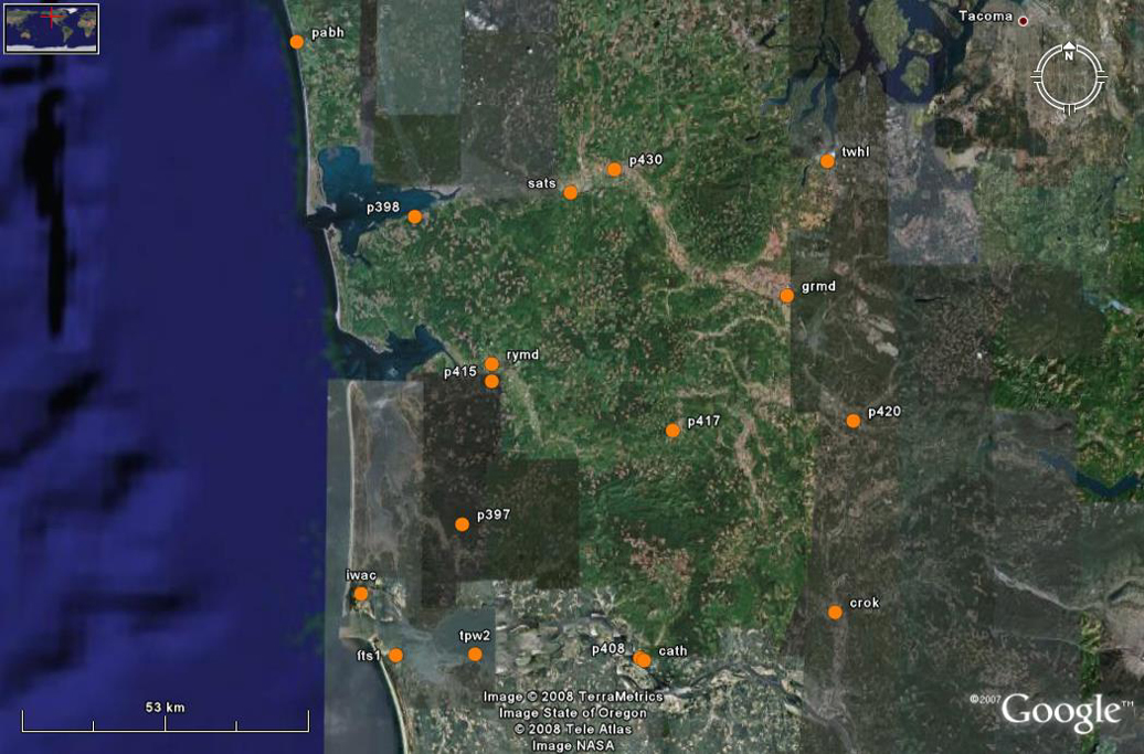
Regional Clusters of
stations showing only the longitude for clusters in the Olympic
Peninsula (WOP) and south of there in the Willapa Hills (WWH).
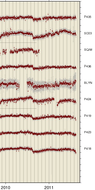
Note that the Aug. 2010 ETS can be seen on many of the stations in the Olypics
group but only a few in the Willapa Hills group.
The current ETS shows up strongly on many Willapa Hills stations and only
now is getting started on stations in the Olympics.
/ul>