The surface displacements due to slip on the deep subduction zone
interface is generally best seen in the east (longitude)
component of the GPS time-series.
The time series below shows how the computed position of the
GPS station changes with time. For example if the dots move upward
on the longitude plot, it means that the station is shifting
to the east. If the dots move downward, it means that the station
is shifting to the west.
The plot below shows east-component GPS data for several stations.
The initial deep seismic tremor of 2004 began April 26,
south of Puget Sound. A vertical line shows
May 3rd when the motion was first detectable
from GPS data. Another line indicates May 18 when the motion apparently stopped. The
total duration of the slip event was about 2 weeks.
Two gray lines on the left part of the plot define the time
period of the last slip event from February 26 to March 19, 2003. Deep seismic
tremor was also reported at that time.
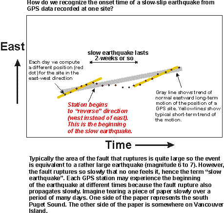
The deviations from normal motion at the earth's surface
for the May, 2004 slip event are about 5 mm (to the west).
With continued slip we see further westward motion
at these sites, as illustrated in a
cartoon diagram of a GPS time series at an imaginary station. Look for a cessation
of westward motion to indicate the end of the slow-slip event.
The next figure shows a map view summarizing displacements
between May 1 and May 19th, 2004.
Notice that the sites (particularly in the
south Puget Lowland) are moving in a direction opposite to the
usual NE direction.
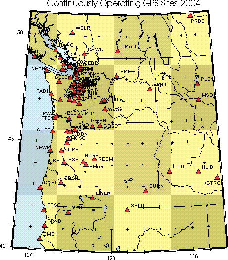
GPS data from tracking sites located across the Pacific Northwest were
processed at UW using GIPSY/OASIS II software, with orbit and clock
information provided by the Jet Propulsion Laboratory.
Data are initally processed in point
position mode before application of ambiguity resolution. Local results
are combined with solutions from other sites on North America and are
expressed relative to a fixed-North America datum. For details
see Dan Johnson (dj@ess.washington.edu) or Tony Qamar (tony@ess.washington.edu)
When slip on an earthquake fault occurs, even deep in the earth, there is a small but often
detectable shift of the ground at the earth's surface. This can be monitored on a day-to-day
basis with high precision Global Positioning System (GPS) instruments.
An array of GPS instruments in Washington
allows us to see evidence of "silent slip" occurring at depths of 40-65 km under the Puget Lowland
May 3-18, 2004

(also available is
a smaller scale map showing GPS instruments in the
entire Pacific Northwest).

