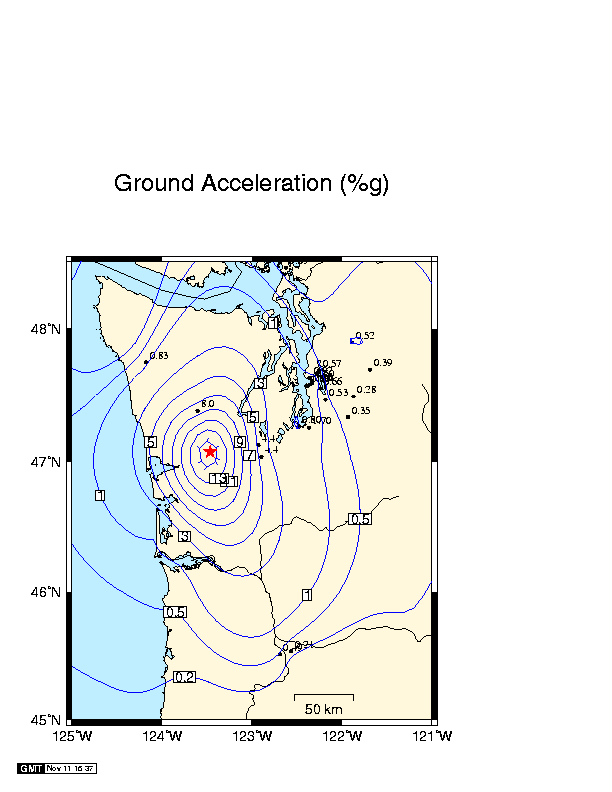
Peak Ground Acceleration for the July, 1999 Satsop Earthquake, Depth 41 km

Peak Ground Acceleration for the July, 1999 Satsop Earthquake, Depth 41 km |
|
This is a draft map ( also available are
JPEG [61k] and Postscript
[72K] versions)
of peak ground accelerations for the July, 3, 1999 Satsop earthquake
that occurred at a depth of 42 kilometers. The focus of this earthquake was
in the subducting
Juan de Fuca plate, not in the overlying North America plate. The map shows recorded
ground accelerations in percent of g (1 g = 9.8 m/sec**2). The measured accelerations were
determined from a combination of the PNSN's digital real-time accelerographs
and broad band seismic stations, plus information from old-style USGS accelerometers. Some of the stations used to contour the data lie off the map in Oregon, Canada, and
eastern Washington.
The star shows the epicenter of the earthquake. The contours show a smoothed version
of the expected ground accelerations modified by the actual observations.