|
|
The Pacific Northwest Seismograph Network
|
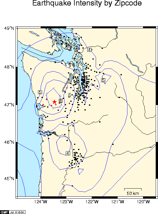
The map was produced from Internet WEB responses from hundreds of individuals who filled out the Request for Earthquake Information form. A Summary of the responses in table format is also available.
Each dot on the map represents one or more responses averaged for a particular zip code. The average intensities in each zip code region were then smoothed and contoured using a semi-automatic computer algorithm. The felt reports have not yet been extensively checked for errors. Red dots show sites with the highest average intensity (5.8 and greater). Intensities below IV are not contoured and the exact location of the intensity IV contour itself is rather uncertain in several areas because of the small number of felt responses in outlying areas.
The red star indicates the epicenter of the main shock.