This is an automated web page produced after a
significant earthquake to give essential information about the
earthquake, its aftershocks, and previous earthquake activity
in the region. Some of the information here will be
updated as aftershocks occur.
DID YOU FEEL IT index search for PNSN
- You can report shaking and damage at your location.
You can also view a map displaying a summary of data
received from all reports. Only four felt reports for one earthquake have been received.
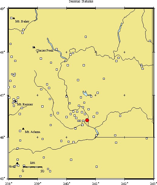
View Seismograms of station WIW for current time
- View web-based seismograms by station and date.
Tectonic summary - Brief interpretation for this swarm.
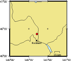
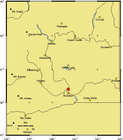
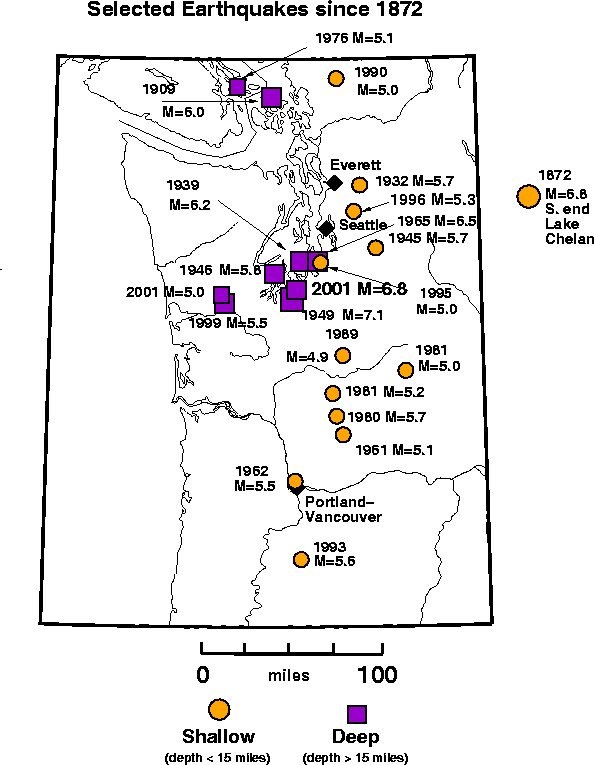
Maps and History of Earthquakes in this Region
Swarm Activity -
The following information will be updated as new events occur.
Included are:
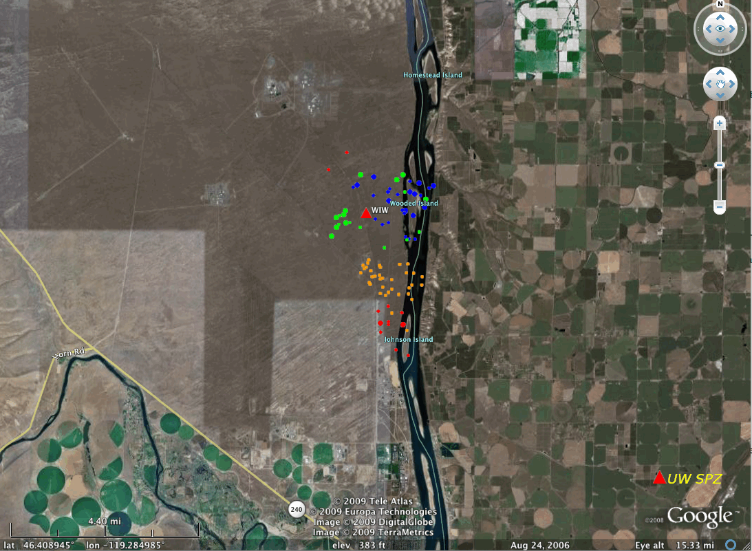
- Comparison map of locations from the current swarm
(orange), the 1970 swarm (green), the 1975 swarm (blue) and the 1988 swarm (red). Short-period seismic station WIW is red triangle.
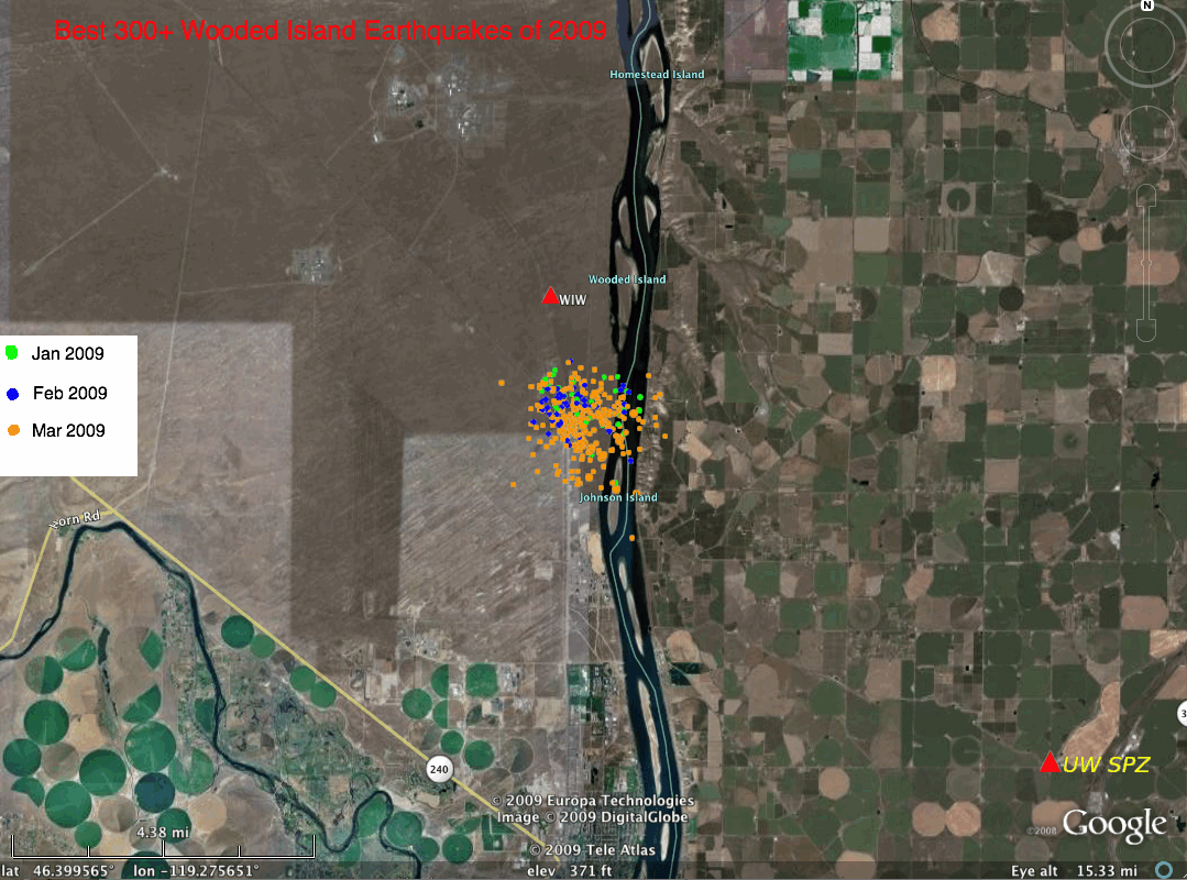
- Map of the best locations from the
current swarm color coded by the month they occurred.
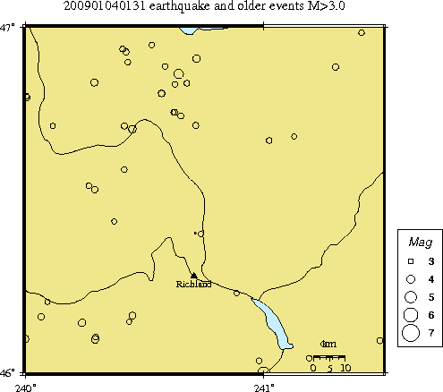
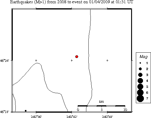
- An Earthquake Catalog listing the location and magnitude of all earthquakes we have located in the epicentral region during the current year.
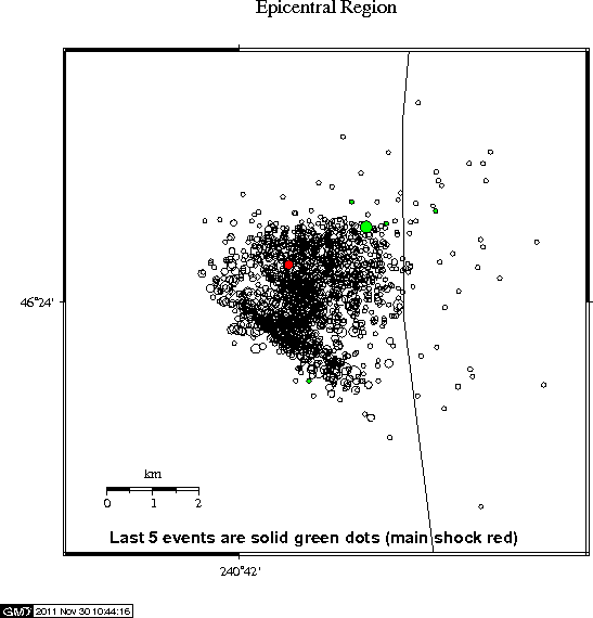
- Detailed Map of all earthquakes in this catalog for the epicentral region.
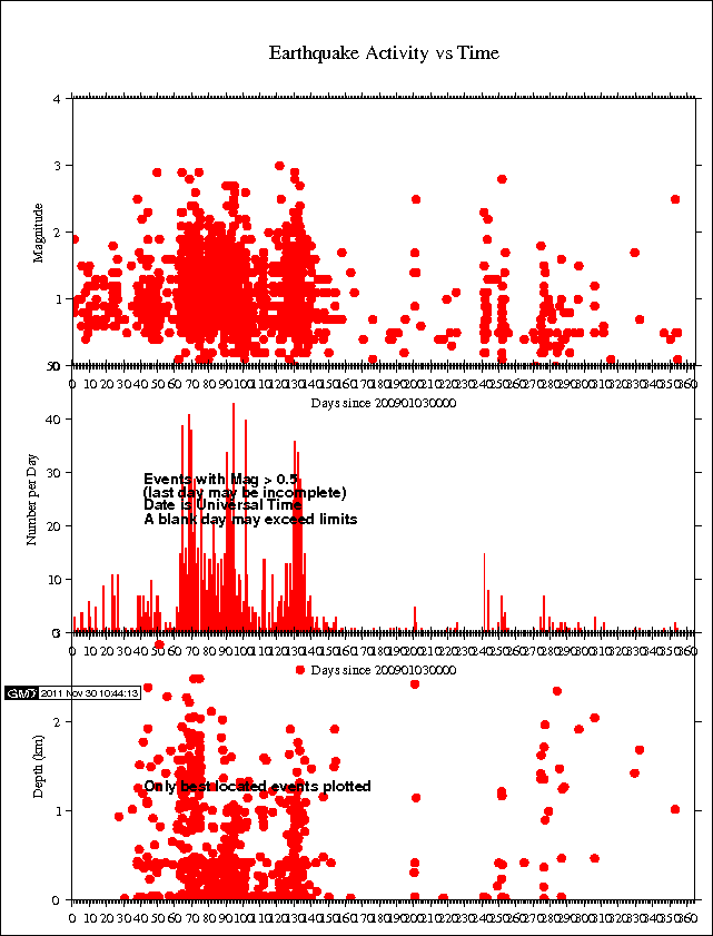
- Seismic Activity (magnitude, rate, depth) as a function of time since the start of the swarm.
Focal Mechanism - A diagram and table of the P-wave fault plane solution. If sufficient P-wave first motion data are available, a fault plane determination for the earthquake will be available.
Strong-Motion Information - for some earthquakes a ShakeMap based on recorded data from digital accelerographs is available.
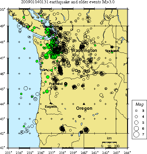
Related Information - Most Up-to-Date Local and Global Earthquake Summaries
- Latest Quakes from the Pacific Northwest, the nation and the world