PNSN Logo
The Pacific Northwest Seismograph Network

All about earthquakes and geologic hazards of the Pacific Northwest        

Link to USGS Pages
   HOME | Latest Quakes | Catalogs & Data | Hazards | Research | Outreach & Education | Preparedness & Mitigation | Operations & Projects   
  

Earthquake Report

Magnitude 3.1, S of North Bend, WA
Monday July 22, 2002 at 00:27:34.91 (PDT)

UW | Dept. of E&SS | USGS EQhazards | REPORT AN EARTHQUAKE | USGS Seattle | Seismosurfing | Site Map |
Magnitude 3.1
Time Monday July 22, 2002 at 07:27:34.91 (UTC)
Monday July 22, 2002 at 00:27:34.91 (PDT)
Distance from 9.8 km S of North Bend, WA
19.2 km SSE of Fall City, WA
46.6 km ESE of Seattle, WA (1st & Yesler)
Coordinates 47.409 deg N
121.785 deg W
Depth 28 km
Quality good (BA)
Note: 1 km = 0.621 mile or 1 mile = 1.61 km
Map showing epicenter
Name of Event File: 02072207273p

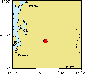
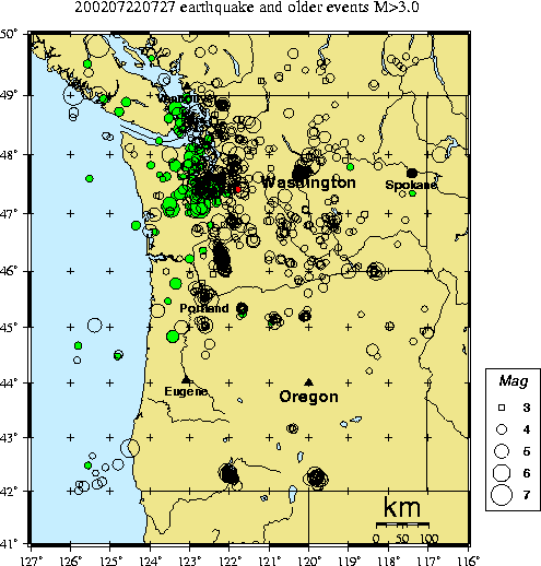
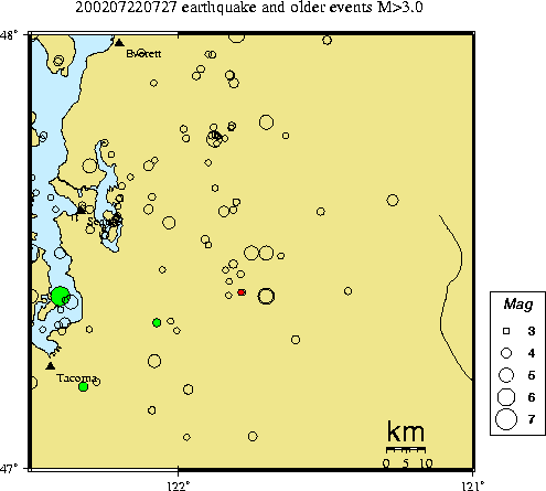
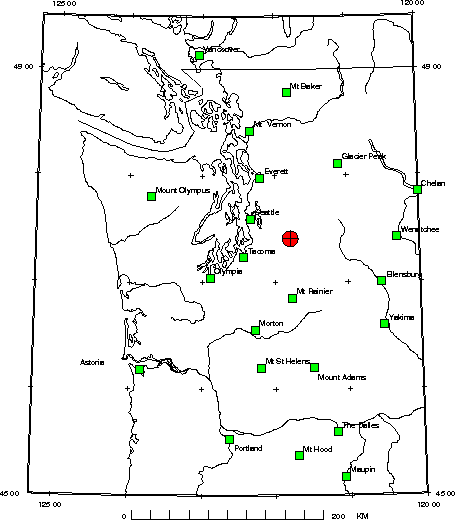
This is an automated web page produced after a significant earthquake to give essential information about the earthquake, its aftershocks, and previous earthquake activity in the region. Some of the information here will be updated as aftershocks occur.
  • SHAKE MAP list for PNSN - For certain earthquakes a map of shaking intensity based on measurements from strong-motion seismographs will be available.

  • DID YOU FEEL IT index search for PNSN - You can report shaking and damage at your location. You can also view a map displaying a summary of data received from all reports.

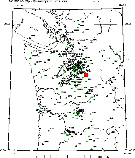
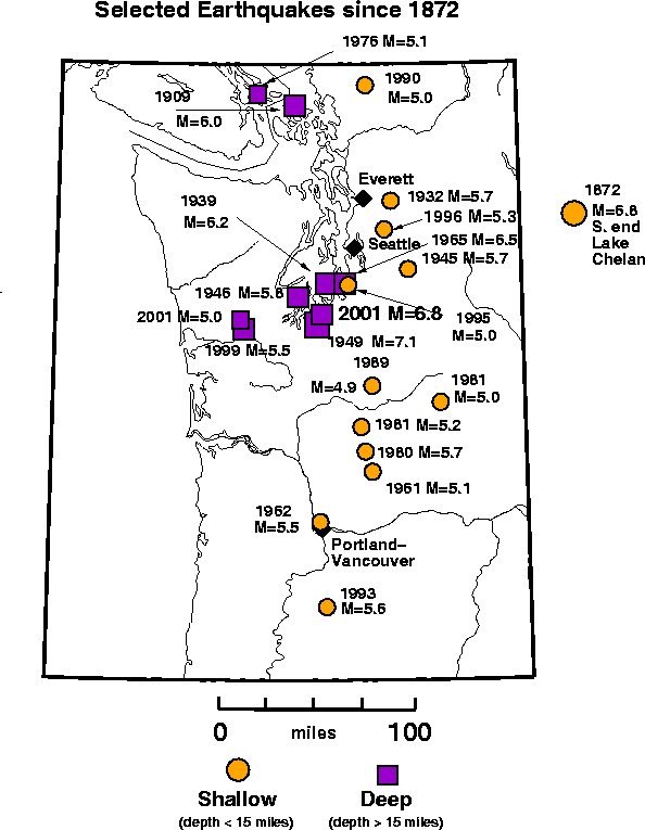
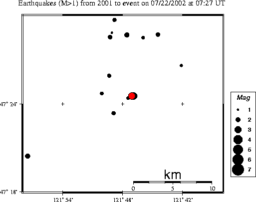
    View Seismograms - View web-based seismograms by station and date.

    Maps and History of Earthquakes in this Region

    Focal Mechanism - A diagram and table of the P-wave fault plane solution. If sufficient P-wave first motion data are available, a fault plane determination for the earthquake will be available.

    Strong-Motion Information - Data from digital accelerographs.

    Related Information - Most Up-to-Date Local and Global Earthquake Summaries

    • Latest Quakes from the Pacific Northwest, the nation and the world