PNSN The Pacific Northwest Seismograph Network

PNW EARTHQUAKE INFORMATION


Earthquake Report

Magnitude 3.0, S of Vancouver,BC
Wednesday July 3, 2002 at 05:22:45.66 (PDT)

Magnitude 3.0
Time Wednesday July 3, 2002 at 12:22:45.66 (UTC)
Wednesday July 3, 2002 at 05:22:45.66 (PDT)
Distance from 21.9 km S of Vancouver,BC
44.4 km N of Friday Harbor, WA
45.4 km WNW of Bellingham, WA
Coordinates 48.933 deg N
123.045 deg W
Depth 14 km
Quality poor (CD)
Note: 1 km = 0.621 mile or 1 mile = 1.61 km
Map showing epicenter
Name of Event File: 02070312224p

This is an automated web page produced after a significant earthquake to give essential information about the earthquake, its aftershocks, and previous earthquake activity in the region. Some of the information here will be updated as aftershocks occur.
  • SHAKE MAP list for PNSN For certain earthquakes a map of shaking intensity based on measurements from strong-motion seismographs will be available.

  • DID YOU FEEL IT index search for PNSN You can report shaking and damage at your location. You can also view a map displaying a summary of data received from all reports.

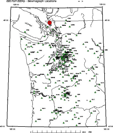
    View Seismograms - View web-based seismograms by station and date.

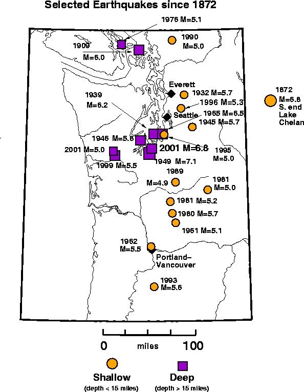
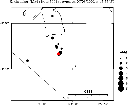
    Maps and Earthquake History - Our data base of earthquake hypocenters contains information from the 19th century to the present. Included are:

    Focal Mechanism -

    Strong-Motion Information - Data from digital accelerographs.

    Related Information - Most Up-to-Date Local, National, and Global Earthquake Summaries

    This is file /spikehome/HTML../WEBDIR_02070312224p/02070312224p/welcome.html
    Created Fri Jul 19 10:06:39 PDT 2002. Template last modified 7/18/02