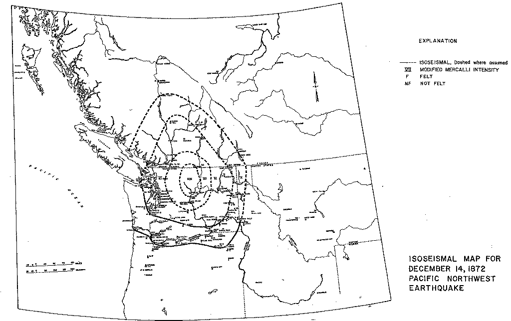
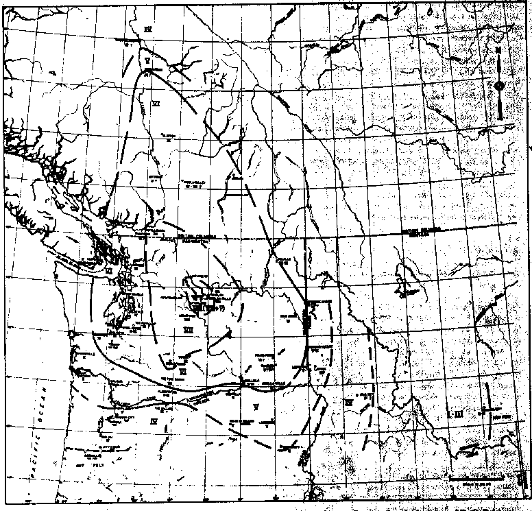
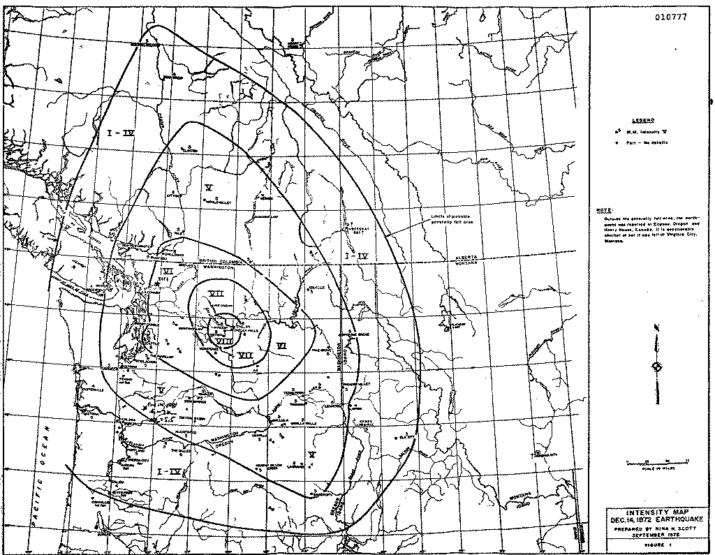
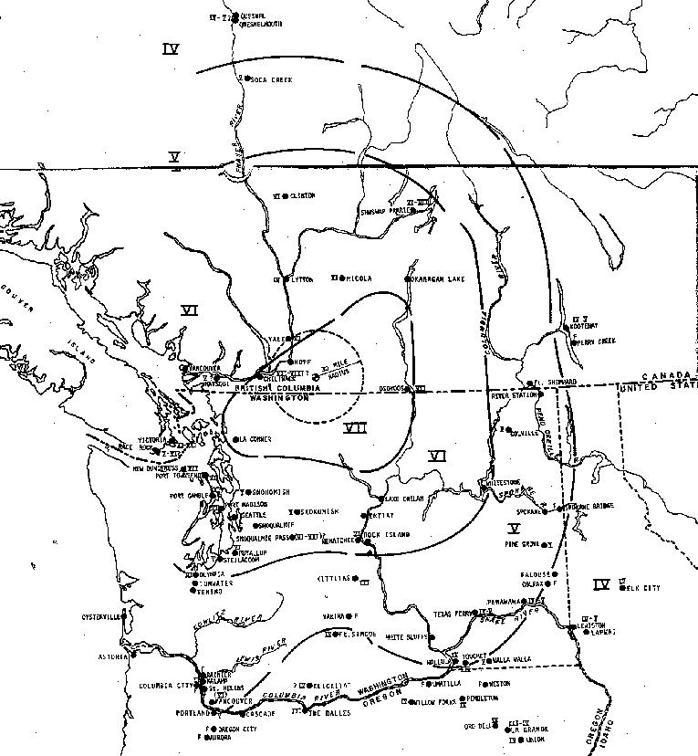
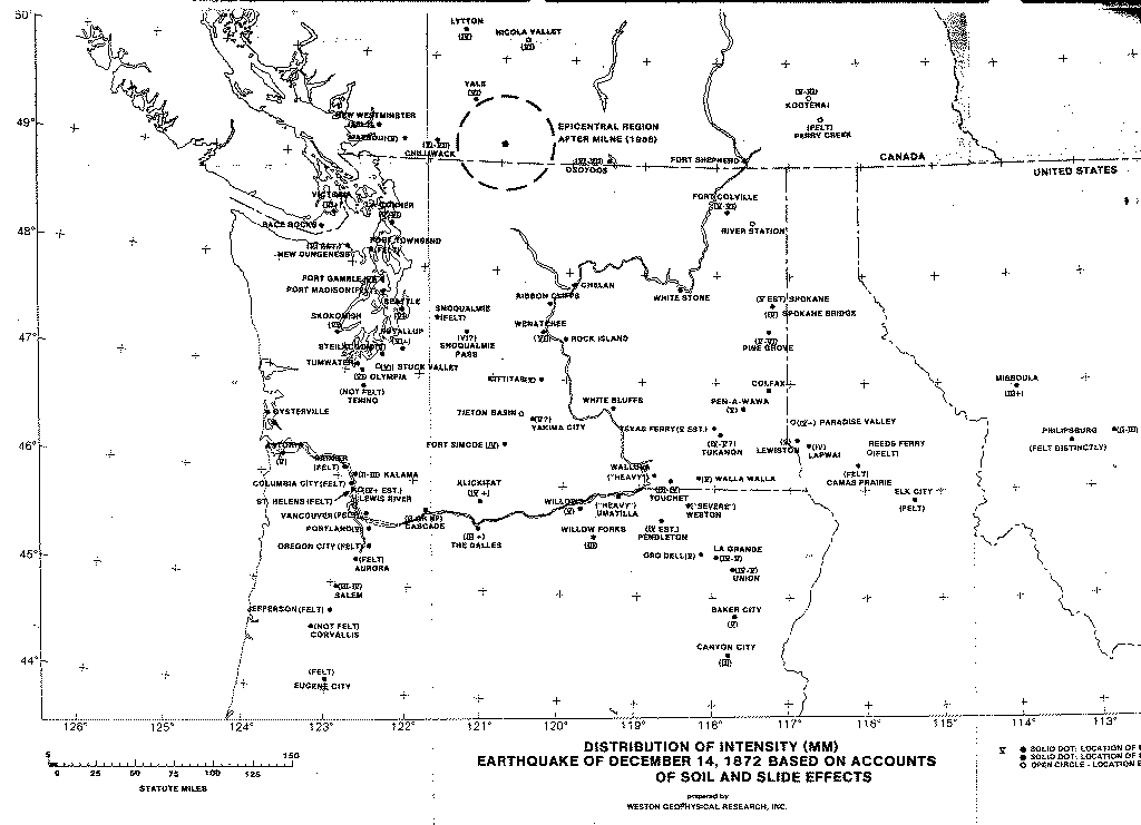
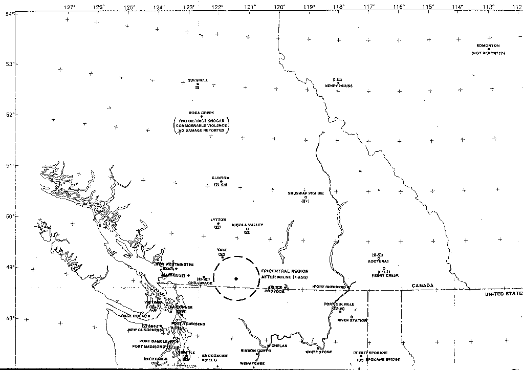
WHAT ARE ISOSEISMAL MAPS?
An isoseismal map shows countours of earthquake intensities.
A single earthquake
will produce different intensities at various places.
WHAT ARE EARTHQUAKE INTENSITIES?
Earthquake intensity is a measure of the
amount of ground shaking at a particular site, and it is
determined from reports of human reaction to shaking,
damage done to structures, and other effects.
The
Modified Mercalli Intensity Scale
is now the
scale most commonly used to determine intensities for earthquakes felt in
the United States.